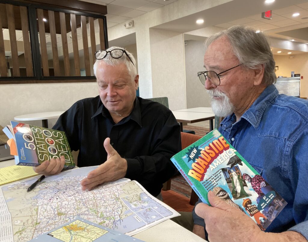
Carefree, Arizona — I’ve spent the last two days working with my friend Frank Lister on the great Travels with Charley tour itinerary for 2024. I’ll start from Bismarck on or about May 2. Steinbeck traveled the perimeter of the United States. So will I. The journey will roll out in three phases: Bismarck to Sag Harbor on Long Island and back again; Bismarck to Amarillo, Texas, and back; and Amarillo to New Orleans and then up the east coast to New York City.
Frank brought an atlas and three or four books about campgrounds, roadside attractions, national parks, etc. I brought a different atlas. We both had colored magic markers. And, of course, I had a copy of Steinbeck’s Travels with Charley and Bill Steigerwald’s critique of Steinbeck’s journey (which he regarded as largely fictional), Dogging Steinbeck.
We spread out in our hotel lobby on a vast table that fortunately had USB ports and electrical outlets. We plugged in computers and an iPad, spread out the maps, and went to work. It was an impressive sight. Several people having breakfast or wandering through came by to ask what we were doing, offer advice, and tell us how much they would like to do such a thing. Of course, they wondered whether I would take a dog. (And they didn’t even see the Airstream, with its elegant Listening to America logo on the side!)
It was a long day. We made great progress. We plotted a plausible route, preferring back roads (blue highways) whenever possible and staying as close to Steinbeck’s actual route as practicable. Of course, there are countless other things I want to see on the great journey, so we had to make hard choices about what was possible in the three five-week segments. We picked potential stopping points and even campsites. I looked up distances between stops on my smartphone. But Frank brought a geometrician’s compass and showed off by twirling it over the physical maps. He was spot on in his retro calculations.
We went out for lunch to take a break, but even then, we could not stop talking, planning, imagining, and dreaming about the journey.
The girls looked at us initially puzzled, but then one of them said joyously, “Wow. So old school.”
By the end of the day, we were exhausted. Just as we were about to fold up the maps and close the atlases, a mother walked past our table with her two children, both girls, one about nine, the other perhaps seven. The girls looked at us initially puzzled, but then one of them said joyously, “Wow. So old school.” Their mother quickly shushed them as if they were passing through a nursing home or a museum with realistic animatronic geezers.
Printed maps!
Frank is in his 70s, I’m in my 60s. We laughed with joy and shame, moved about 50 feet into the bar, and ordered beers. We felt medieval.

It was sweet and amusing. We only wished we could stop the blushing mother long enough to explain to her daughters how printed maps worked. I would have enjoyed Frank trying to explain his compass, and I might have quoted a few lines from John Donne’s A Valediction Forbidding Mourning, which pivots on a geometer’s compass. Thank goodness Frank left his astrolabe at home.
I can’t imagine making any long journey in America without a map or an atlas. Those young people cannot imagine making a journey without letting Google Maps take care of the navigation.
Old School, indeed. Our new nicknames are Mercator and Ptolemy.
