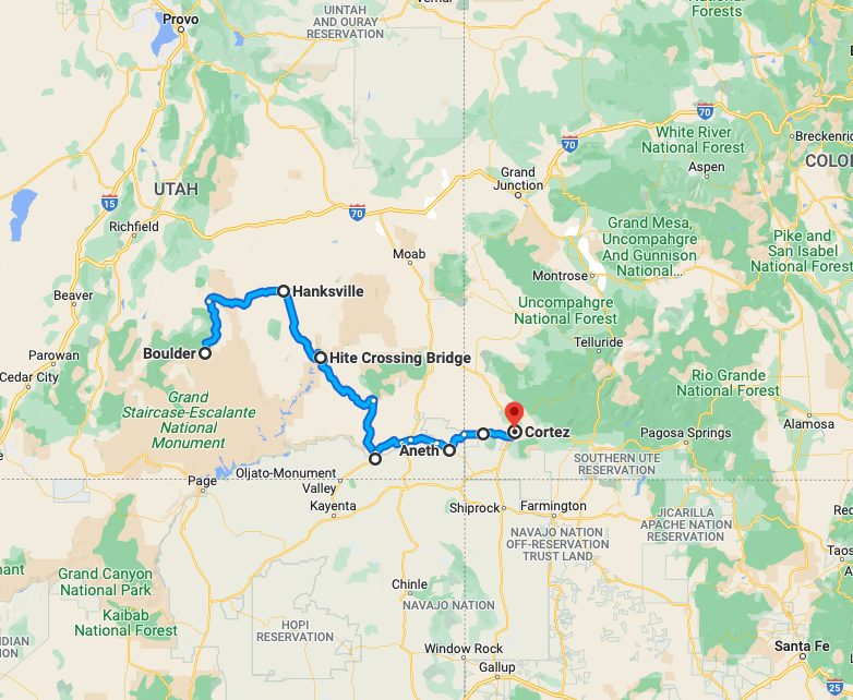
Day Three, Sunday: Utah 12 to Torrey; Utah 24 to Hanksville; Utah 95 to Natural Bridges National Monument; Utah 261 to Mexican Hat; U.S. 163 to Bluff; Utah 162 to Aneth; Indian Route 5068/Arizona County Road G to Cortez.
This is the fourth in a series of dispatches from Clay Jenkinson chronicling his recent journey with two compatriots following the Colorado River and neighboring region. The day was spent deep in the canyon country of Utah, Arizona and Colorado. The two-week expedition explored the state of water, or the absence of it, in the West.
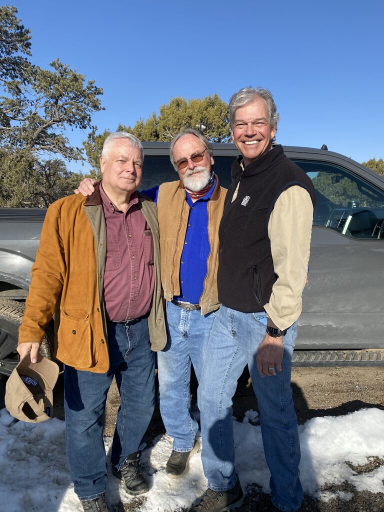
Today we get officially underway. Frank’s wife Georgie dropped him off around 9 a.m. As we began the great adventure, she handed us a Ziplock bag full of homemade chocolate chip cookies. Dennis and Frank know southern Utah, so as we drove away, they traded identifications, histories, and stories that were all new to me.
Whether Frank is the best-connected guide in human history, or we met all ten people he happens to know in canyon country is unclear, but he seems to know everyone. He seems to be the Forrest Gump of greater Utah. As John Quincy Adams once said of Thomas Jefferson, “he tells large stories.” Frank issues a lot of sentences per day that a skeptic might characterize as what are technically known as “whoppers.” Except for his claim that he dragged Edmund Hillary the last steps up Everest in 1953 and that he once played for the Dallas Cowboys, Frank’s stories tend to check out. I Googled the first few dozen. They were all true. So, I gave up being a Frank skeptic and just rolled with it.
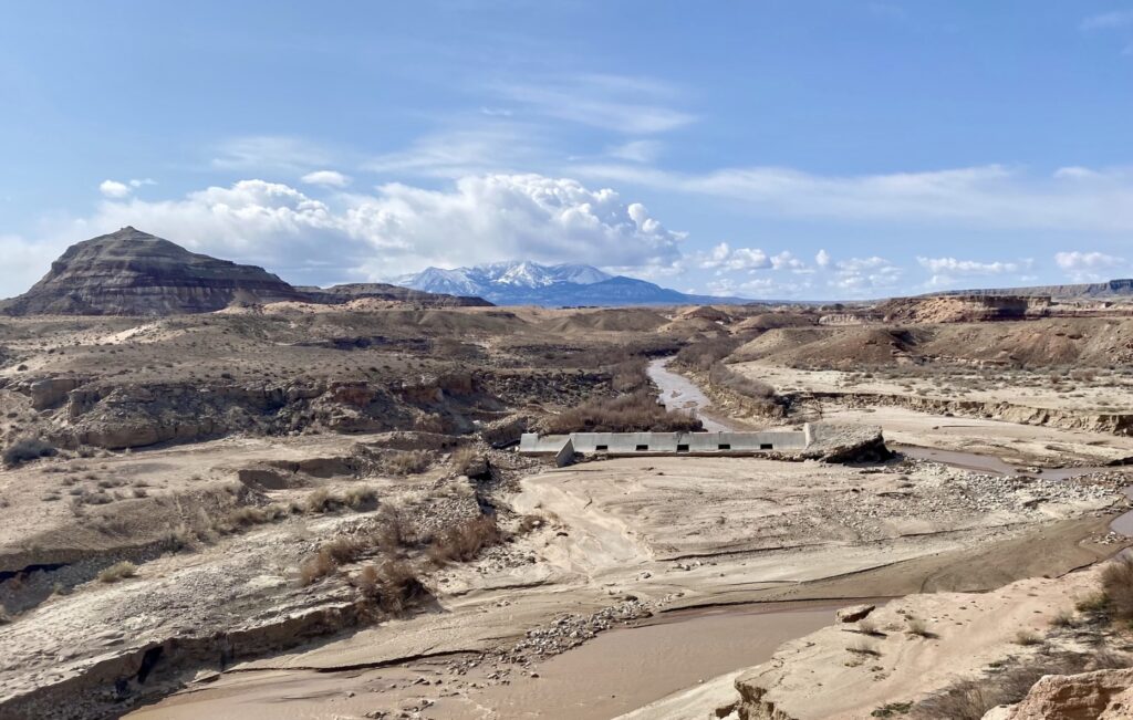
We stopped first at a blown-out check dam on the Fremont River. During sudden heavy rains and major flooding a couple of years ago (2021) the usually placid Fremont blew the dam right out of its base. I remember reading years ago that when you double the volume of a river, you square its capacity to carry mass. Thus, a river that seems entirely tame and perhaps even pitiful on a normal day can, when the big waters come, carry boulders the size of automobiles. We took pictures from every possible angle. As Edward Abbey noted several times in his great book Desert Solitaire, the Southwest is a region where there is far too little water most of the time, and then suddenly far too much for a very short amount of time. If, ten years ago, you asked 1,000 visitors to this site what it would take to blow out that dam, they would say dynamite or a small atomic device. And yet, after one of the late summer monsoon rains here, the modest Fremont just plucked it off its foundation. When the engineers nearly lost Glen Canyon Dam in 1983, they feared two things. First, if the water actually spilled over the top of the dam it might do extensive damage on the downstream face of the dam. That’s why they erected a continuous series of plywood panels on top of the dam to keep the rising reservoir from spilling. They succeeded — narrowly. Second, they discovered that the water they were diverting through the tunnels was eating away at the concrete down where they made an L-shaped turn. As the crisis deepened, concrete and rebar spewed out of the tunnels like so much popcorn in an air popper. Engineers feared that these gigantic flows through the tunnels might be eating away at the sandstone abutments of the dam. It could not be completely ruled out that the dam might be pulled loose just like the little check dam on the Fremont. As soon as the crisis was over, the Bureau of Reclamation went in to inspect and repair the tunnels. They were astonished by what they observed. I don’t suppose this should surprise us. The unbelievable power of water can be seen in every canyon in the American Southwest, most dramatically in the Grand Canyon, which at times, as John Wesley Powell put it, is “a mile into the depths of the earth.” Our journey is about the scarcity of water in the West, but it is also about the power of water.
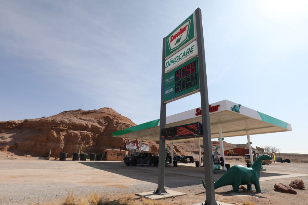
We stopped for gas and soda at the Hollow Mountain convenience store and Sinclair station, not far from Hanksville, Utah. After taking the requisite pictures and stretching, we walked into the hollow mountain. As I opened the door, I heard someone preaching. I paused, trying to figure out what was going on, not wishing to disturb what I reckoned was a local church service in an unusual place. But I soon realized that the clerk behind the desk was watching a service on television. I asked an innocuous question about what she was watching. “I’m LDS, that’s the Church of Jesus Christ of Latter Day Saints,” she said. “It’s Conference. You go if you can. Otherwise, you watch it on TV.” She was a little defensive/defiant, as if I might make a joke about Joseph Smith or polygamy. But I have spent a lot of time in LDS country and I have done a lot of reading about Smith, Brigham Young, the ex post facto proxy baptism of the Founding Fathers, including the Deist and unitarian Thomas Jefferson. Maybe she saw some half-suppressed smirk in me of which I was unaware. My view of the LDS world is overwhelmingly favorable, actually, and of course another person’s religious views are none of my business. Many see the Declaration of Independence as Thomas Jefferson’s greatest hit, but I believe that honor belongs to his Virginia Statute for Religious Freedom (1786), which separated church and state in America. I had never heard of “Conference,” but Frank explained it when we got back into the pickup. It seemed like a lonely existence out here near Hite and Hanksville. The Hollow Mountain store was a throwback to the Route 66 era of American roadster tourism, when you could stay in a motel in the shape of a teepee or a space rocket.
We drove through gorgeous canyons all day long. All I could do was press my face up against the windows of the pickup and take reference photos every time I was especially wowed. We were driving through canyons that are nearly nameless, certainly not named in recognizable ways.

When I looked up at the scores of canyon walls and cliffs through which we threaded our way to Cortez on that early spring Sunday I realized once again how ignorant I am. I don’t know Precambrian from Pretoria, Mesozoic from Minneapolis. I know that there are countless layers of mostly sedimentary rock jammed together by eons of accumulation and the force of gravity. I can identify Navajo sandstone and desert varnish and that’s about it. It’s worse than that. Once every five or six years I decide that I should get up to speed with at least basic geological knowledge. I buy new books. My library includes the Roadside Geology of Colorado, of Arizona, of Utah, of Wyoming, and of Montana. But when I start to read these books, including Geology for Dummies, it doesn’t take more than half an hour for my brain to cloud over. Either I am too lazy to do the hard work of learning basic geology or for all but a handful of specially gifted people the world of geology is tedious and impenetrable.
This puts me at a real disadvantage in canyon country. You can only see what you have eyes to see. The lens you wear determines what you can see. If you don’t know any constellations when you look into the night sky, you see only zillions of stars. According to the experts, you can see approximately 5,000 stars with the naked eye if you live where there is real night darkness. But if you know Cassiopeia, the two dippers, Orion, and a few others, and such planets as are available for viewing at any given season, your pleasure in sky watching increases. I wish I were able to “read” the canyons, but since I have been too lazy to learn the working vocabulary, I’m just stuck at awe. My two colleagues, who are more advanced in this science than I am, don’t know much more than I do. We know we are driving through deep time. We recognize folds. I know some of John Wesley Powell’s contributions to geology, but what little I know belongs to the science of geomorphology rather than what a 3,500-foot cliff signifies.
You could spend a lifetime learning to read the Grand Canyon or the Vermillion Cliffs. If my two Utah friends took a new 10-mile hike every day within a half hour’s drive from their homes, how long would it take them to exhaust even their small bit of the West? If on that hike you wanted to be able to identify every plant you saw, how long would that take? How long would it take you to determine which plants were edible, which not, which useful in healing and which toxic? Alexander von Humboldt designed a circular color wheel to be able to describe the skies of South America with scientific accuracy and to build a taxonomy of variations of the color blue. How long would it take to learn to identify all the animal tracks one sees in an average day’s hike? What can a non-expert learn about these things in a lifetime, when there are other things one must do and other things one needs to know?
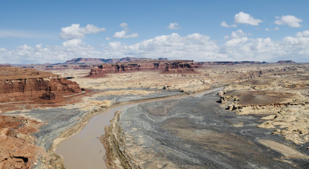
We stopped at an overlook above the marina at Hite, now marooned far from the Colorado River thanks to drought years that go back well before the current crisis. We were so fixated on the deserted marina that we nearly failed to observe the confluence of the Colorado and the Dirty Devil River, a largely insignificant stream that played a role in the drama of the 1869 Powell Expedition.
Editor’s Note: You can track Clay’s dispatches on this Colorado River Journey by following the links from his route and itinerary below. You can also keep up with all LTA’s dispatches, essays, photos, and podcasts on this topic through the tab “Water in the West.” This is one of many ongoing road trips at the heart of Listening to America. Our mission is to “light out for the territories,” traveling less visited byways and taking time to see this immense, extraordinary country with fresh eyes while listening to the many voices of America’s past, present, and future.
Water in the West — Routes and Itinerary
- Introduction: A Colorado River Journey, The Trek Begins.
- Day One, Friday: I-70 Vail to Green River; Utah 24 to Torrey; Utah 12 to Boulder, Utah.
- Day Two, Saturday: Boulder, Utah.
- Day Three, Sunday: Utah 12 to Torrey; Utah 24 to Hanksville; Utah 95 to Natural Bridges National Monument; Utah 261 to Mexican Hat; US 163 to Bluff; Utah 162 to Aneth; Indian Route 5068/Arizona County Road G to Cortez.
- Day Four, Monday: Crow Canyon Archaeological Center, Cortez, Colorado.
- Day Five, Tuesday: Colorado 160/491 to Chimney Rock; Colorado 160 to Teec Nos Pos; Colorado 160 to Mexican Water; U.S. 191 Tsaile; Arizona 64 to Chinle.
- Day Six, Wednesday: Canyon de Chelly; U.S. 191 to Burnside; Arizona 264 to Second Mesa.
- Day Seven, Thursday: Hopi Cultural Center; Arizona 264 to Tuba City; U.S. 160 to U.S. 89; U.S. 89 to Bitter Springs; U.S. 89A to Marble Canyon.
- Day Eight, Friday: U.S. 89A to Bitter Springs; U.S. 89 to Page, Arizona.
- Day Nine, Saturday: Lake Powell; U.S. 89 to Kanab.
- Days 10 & 11, Sunday/Monday: U.S. 89 to Utah 20; Utah 20 to I-15; I-15 to Salt Lake City.
- Days 12 & 13, Tuesday/Wednesday: Salt Lake City.
- Reflections on A Colorado River Journey.
