One of America’s truly grand rivers, the Ohio ranks eighth in length in the United States but second in volume.

When I finally arrived at the mouth of the Ohio River in Cairo, Illinois, I was overwhelmed by its mass. The Ohio River ranks eighth in length in the United States but second in volume. More than the Missouri. More than the Colorado. More than the Columbia! Its flow is just about half that of the Mississippi, the Father of Waters.
I’m accustomed to the rivers of the West, like the Missouri, the Colorado, and the Yellowstone, all of which have late-summer stretches of sandbars and shallows. Driving over the high, narrow Ohio River bridge on the road from Paducah, Kentucky, to Cairo, Illinois, I felt a mix of awe and fear. You can drown in the bathtub — I know someone who drowned in a hot tub — but you would be hard-pressed not to drown in the Ohio or the Mississippi.
In a handful of days, I drove from Pittsburgh, Pennsylvania, to Cairo, Illinois, as much of it as possible on highways adjacent to the river. It’s so well-watered, fertile, and forested in this region of the country, however, that you get to see the Ohio only in glimpses. The millions of trees obstruct everything, including some of the industrial plants that perch on the river’s banks. The Ohio is not a welcoming river. I’d be hesitant to wade in even at one of its beaches. If we had no Mississippi, American memory would make a great deal more of the Ohio.
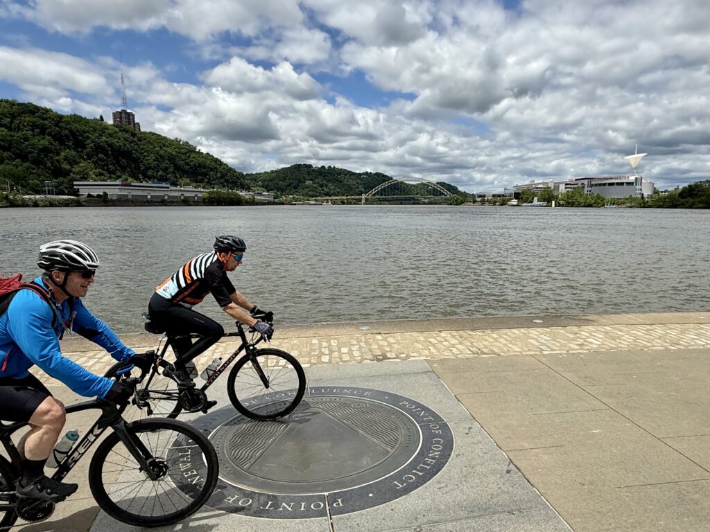
In Pittsburgh, I spent an hour or more at the “source” of the Ohio, at a concrete plaza called Point State Park. Bicycles whiz through the plaza, and lots of people are taking selfies. Fathers explaining the three rivers. On your right, the Allegheny; on your left, the Monongahela, and — voila — right in front of you, the Ohio. Throughout my life, I have been fascinated by the sources of rivers: the Mississippi at Lake Itasca in northern Minnesota, the Missouri in extreme southwestern Montana, the Columbia at Columbia Lake in British Columbia, and my own river, the Little Missouri, with its source near Devils Tower in Wyoming. No matter what the U.S. Geological Survey says, I refuse to accept that the Missouri’s source is at Three Forks, Montana, where the Gallatin, Madison, and Jefferson rivers conjoin, or that the source of the Ohio is at Point State Park in Pittsburgh. A river’s source has to be some creek you can bestride or some spring you can sip and not be swept to your death.
The U.S. Geological Survey tells us that it is not until the Allegheny and the Monongahela conflow at Pittsburgh that we can call the result the Ohio. That seems perverse and erroneous to me. The Allegheny River, a tributary of the Ohio River, is 325 miles long. It starts just south of the New York border at Cobb Hill in Allegheny Township. Alas, I have never been there. The Monongahela River, a tributary of the Ohio River, is 130 miles long. It starts in West Virginia. In my mind, the feeder creek farthest from the sea should be regarded as the true source (veritas caput in Latin) of a river. That suggests that the Ohio is not 981 miles long but rather 981 plus 325 for a total of 1,306 miles long. The Missouri — as I understand hydrology — does not start at Three Forks, even though Meriwether Lewis declared it to be so on July 28, 1805:“Both Capt. C. and myself corresponded in opinion with respect to the impropriety of calling either of these streams the Missouri and accordingly agreed to name them after the President of the United States and the Secretaries of the Treasury and State having previously named one river in honour of the Secretaries of War and Navy. In pursuance of this resolution we called the S.W. fork, that which we meant to ascend, Jefferson’s River in honor of [that illustrious personage] Thomas Jefferson. The Middle fork we called Madison’s River in honor of James Madison, and the S.E. Fork we called Gallatin’s River in honor of Albert Gallatin.”
Naming these three co-equal tributaries for the worthies of the Jefferson administration was a bold act. Imagine someone naming those three streams: the Trump, the Rubio, and the Bessent? Or the Biden, the Blinken, and the Yellen.
In Jefferson’s time, rivers were conceptualized as sinuous ribbons that originated somewhere (Point A) and terminated somewhere else (Point Z). For someone like Thomas Jefferson, rivers were conceived as water highways. There was one source, and there was one mouth. They knew better than this, of course. They knew that rivers braided at both ends of their journey, with capillary streams that fed the river from several directions and distances, and they knew that the mouth of a river like the Mississippi creates a vast delta of capillaries. They did not then regard rivers as systems, watersheds, and ecosystems. It’s not that they were dead ignorant about such things, but the geographic culture had not yet become especially sophisticated about the hydrology of rivers or the interrelatedness of things.
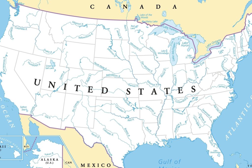
Major rivers of the United States. (Shutterstock)
In a few days, I will visit the confluence of the Missouri and Mississippi about 25 miles north of St. Louis, Missouri. Then, I will see the mouth of the Osage, the mouth of the Platte, the mouth of the Niobrara, and the mouth of the Bad River at Pierre, South Dakota. The Bad is not much of a river, but it is important as the site of the most intense encounter of the expedition with Native Americans.
When I finally get to the Three Forks region of southwestern Montana come July, I have a large geographic agenda. I’m going to climb the limestone hill from which Lewis surveyed the three forks valley (and drew a lost map of it, too). I’m going to try to figure out just where Charbonneau was nearly swept away by the river (north of the Three Forks) but was rescued by William Clark. I’m going to walk across the Missouri River near Twin Bridges, Montana. That was the first place in almost 3,000 miles that the river was shallow enough for Lewis to wade across it. I plan to be swept away by the current, of course, and there is no Clark to fish me out. Then, I am going to go to the two most prominent sources of the Missouri River, far from the U.S. Geological Survey’s Three Forks “source” of the river. One is Lemhi Pass, where Lewis watched his colleague Hugh McNeal stand with one foot on either side of this little rivulet on August 12, 1805, “and thanked his god that he lived to bestride the mighty and heretofore deemed endless Missouri River.” And then I’ll piece my way to the better source creek, one farther from the Gulf of Mexico, at Upper Red Rock Lakes far east of Monida, Montana, and just outside the northern boundary of Yellowstone National Park. Those are legitimate sources. (Unfortunately, the U.S. Geological Survey has stopped taking my calls!)
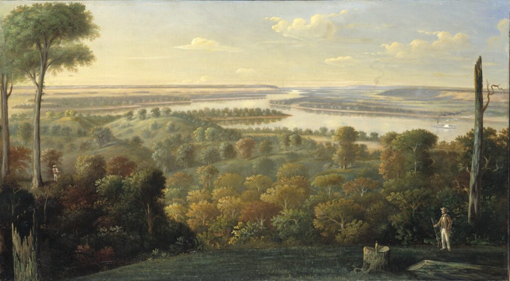
So, I must soon say farewell to the Ohio. The Falls are magnificent at Louisville, Kentucky, and Clarksville, Indiana. Whenever I have seen the Ohio without having to turn my focus away from some giant oil, coal, or chemical plant, it has been astonishingly beautiful. In his book Notes on the State of Virginia, Jefferson, who never saw the Ohio (not even close), wrote, “The Ohio is the most beautiful river on earth. Its current gentle, waters clear, and bosom smooth and unbroken by rocks and rapids, a single instance only ….”
Today, I spent the afternoon sitting on the banks of the Mississippi River at Cape Girardeau, Missouri, with the world of Mark Twain’s Huckleberry Finn dancing in my head. There are few more meaningful places in America than the Mississippi Valley generally and the confluence of the Mississippi and the Ohio in particular because, as Jim tells Huck, if they get to the mouth of the Ohio and turn left, they’ll be in a free state. Jim might be able to live the rest of his life as a free man. But if they miss the confluence (and they do), it’s the Deep South and “no more show for freedom.”
The beauty of Huckleberry Finn (with all of its current problems) makes me ache. If there is a more American book, what is it?