Clay Jenkinson reports on his month-long adventure crisscrossing Montana in the long-since-passed footsteps of Lewis and Clark and their Corps of Discovery.
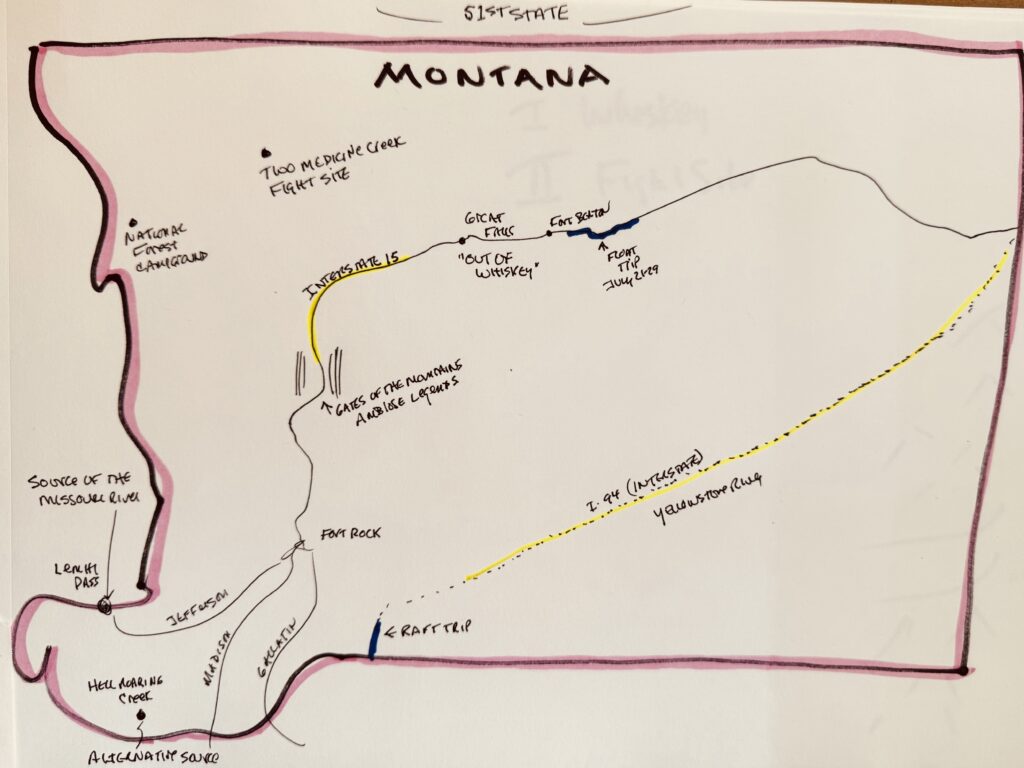
Lewiston, Idaho, August 7, 2025 — I spent more than a month in Montana exploring the Lewis and Clark sites. I left Bismarck, North Dakota, for Phase Two of my national Lewis and Clark tour on July 2, after narrowly surviving the Missouri River pontoon trip with my two favorite rapscallions.
I crossed over into Idaho at 11 a.m. today, August 7.
John Steinbeck had a thing for Montana. In Travels with Charley, he wrote, “I’m in love with Montana. For other states, I have admiration, respect, recognition, and even some affection. But with Montana, it is love.” He went further: “Montana has a spell on me. It is grandeur and warmth. If Montana had a seacoast or if I could live away from the sea, I would instantly move there and petition for admission.”
Lewis and Clark did not know the word Montana. Statehood didn’t come for more than 80 years. Lewis and Clark knew it as the northwestern sector of the Louisiana Purchase Territory. They spent plenty of time in Montana: from April 27 to August 13, 1805 (depending a little on how you count), and from July 2 to August 7, 1806. That’s 108 + 36 = 144 days — a third of a year.
Here’s a short list of what I did in Montana in a month (with a bit of help from the internal combustion engine).
– Drank the last of my whiskey supply on July 4 at the Great Falls, precisely where Meriwether Lewis had his alarming encounter with a grizzly bear (June 14, 1805). Since I am not a whiskey drinker, this did not prove fatal.
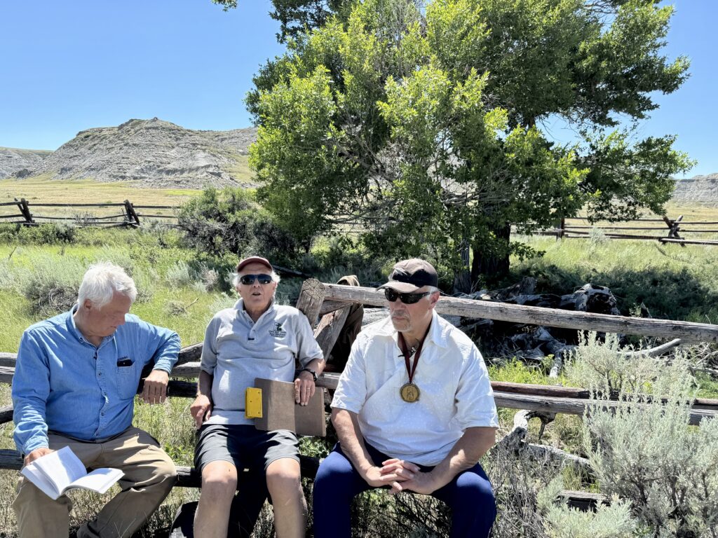
– Visited the Fight Site on the upper Marias River, at Two Medicine Creek, with two remarkable experts: local attorney and historian Larry Epstein, who helped to identify the site decades ago; and Jack Gladstone, the Blackfeet singer-songwriter, storyteller, and commentator who has written wonderfully wry songs about Lewis and Clark and manifest destiny. Lewis and three of his best men had a violent skirmish with eight young Piegan Blackfeet men on July 27, 1806, on the return journey. At least one of the young Blackfeet men was killed, perhaps two. Getting these two extraordinary commentators (Larry and Jack) to the site at the same time has been one of my dreams for many years. They did not disappoint. It turns out that Captain Lewis may have overreacted to the young Indigenous men’s first coup attempt. The Fight Site is a top-10 must-visit place on the Lewis and Clark Trail, but it is not often visited, mainly because it is so far off the beaten path, and you cannot simply drive up to it.
– Took the Stephen Ambrose family memorial excursion boat Sacagawea through the Gates of the Mountains north of Helena, with an outstanding guide Kari (Kahr-ee), who had memorized Lewis’s famous passage about the Gates:
“This evening, we entered many of the most remarkable clifts that we have yet seen. these clifts rise from the watersedge on either side perpendicularly to the hight of 1,200 feet. every object here wears a dark and gloomy aspect. the tow[er]ing and projecting rocks in many places seem ready to tumble on us. the river appears to have forced it’s way through this immence body of solid rock for the distance of 5¾ miles and where it makes it’s exit below has thrown on either side vast collumns of rocks mountains high. the river appears to have woarn a passage just the width of it’s channel or 150 yds… it was late in the evening before I entered this place and was obliged to continue my rout untillsometime after dark before I found a place sufficiently large to encamp my small party; at length such an one occurred on the lard. side where we found plenty of lightwood and pichpine. this rock is a black grannite below and appears to be of a much lighter colour above and from the fragments I take it to be flint of a yelloish brown and light creemcolourd yellow.— from the singular appeaerance of this place I called it the gates of the rocky mountains.”
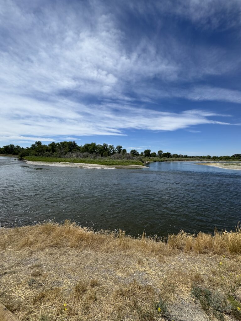
Missouri Headwaters State Park where the Jefferson, Madison, and Gallatin rivers join to form the “start” of the Missouri River. Lewis and Clark visited here in 1805. (Photo Dennis McKenna)
– Spent a day wandering about the three forks of the Missouri at Three Forks: the Madison, the Gallatin, and the Jefferson. I waded into each of the contributory streams, climbed up to Fort Rock from which the captains surveyed the broad tridentine valley, and stayed at my favorite RV park of the summer. Plus sandwiches at Wheat Montana.
– Joined my friends Dennis and Joan, my scholar-daughter, and her scholar-fiancé at Gardiner (where Theodore Roosevelt dedicated the Yellowstone National Park arch in April 1903). New friends Josh and Emily Jo took us on a spirited white water raft trip on the upper Yellowstone, well before it becomes a Great Plains river. Note: my goal has been to get on as many LC-related rivers as possible. I have always wanted to run a bit of the Yellowstone when it was still wild, clear, and not-yet-managed. (I was on the Lochsa River the other day, and I will soon be on the lower Columbia.)
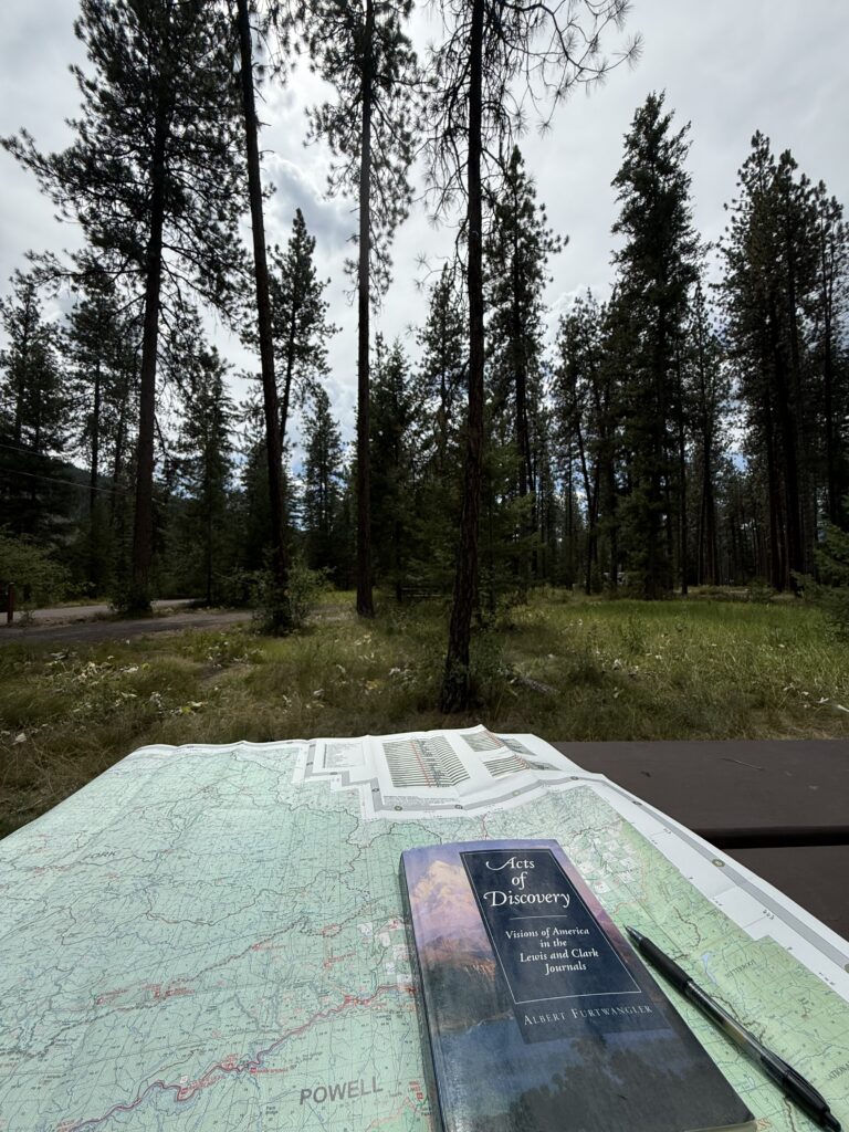
– During all of this time, I read as many hours per day as I could carve out of the logistics of hauling a 23-foot trailer around Montana. I read the journals of the expedition painstakingly, person by person, day by day, with scores of pages of handwritten notes (which are likely to go the way of all of my notes). I’ve also been writing a series of short commentaries, which I call Lewis and Clark Short Bites, about things I am discovering, things I am excavating from clouded memory, and quibbles with Lewis and Clark historians. I try to limit each entry to 250 words. I’m doing research for a book I want to write about the dynamics of the Lewis and Clark journals.
– Twice, I drove Interstate 15 between Great Falls and Helena. The Interstates get a bad rap for finding the least impressive landscapes to dissect, but a handful of America’s Interstate highways are magnificent: I-70 through Glen Canyon in Colorado; I-15 up the Virgin River canyon in Nevada; I-94 along the Yellowstone River between Glendive and Livingston, Montana; and I-15 between Helena and Great Falls. The views of the Missouri River in a state that is almost un-industrialized, s-curving its way through an almost incredible landscape, are enough to make you cry. It must have been extremely expensive to run the four-lane highway through those canyons, but such things make up for a lot of urban dreariness (and injustice).
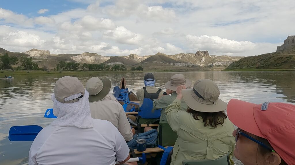
Members of Clay’s Lewis and Clark Cultural Tour paddle toward the White Cliffs of the Missouri River southeast of Fort Benton, Montana. (Photo Nolan Johnson)
– Led my 25th annual Lewis and Clark Cultural Tour from Fort Benton, Montana, by canoe for three days through the White Cliffs section of the Missouri River; then over to the Lolo Trail west of Missoula for very strenuous hiking in the footsteps of L&C. The three-day river float was the easiest in my experience. My taciturn canoe partner, Russ Eagle, and I exchanged approximately one sentence each per river mile. The infamous “Wendover Death March,” 7.5 miles straight up, was rough this year, even though my friend Wayne Fairchild (also my outfitter) had formed a crew to clear the trail earlier this spring. The Wendover trail is constantly beset with fallen trees (Lewis and Clark whined about them, too), but the big wind microburst last year had rendered it impassible. Now — cleared as never before, thanks to Wayne and his crew — one could run up it, if one could run. In addition to all of that, we had great guests (not inevitable), and two great thunderstorms, one of which brought on a flash flood in the Slot Canyon, which might have swept several of us down to the Gulf of Mexico, but relented. The flash flood was one of the top five highlights of all my years on the Missouri. You will remember that Lewis and Clark hired a Native man to lead them through the Bitterroot Mountains. We had our own self-declared “Old Toby” (a guest from Louisiana), and he got us lost just three times. In his bewilderment, like Marlon Brando in A Streetcar Named Desire, our Old Toby bellowed for “My Jaime” (one of the very best of our guides), but she did not respond. She was rumored to be tossing $5 bills at the swimming mermaid at Great Falls’ legendary Sip n’ Dip bar at the time of the incident.

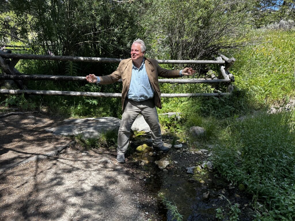
– Ventured with my friends Russ and Liz to the alternative “source” of the Missouri River: Hell Roaring Creek west of Henrys Lake and east of Dillon, Montana. River sources are of great importance to me, and this one, the feeder stream farthest up the Missouri from New Orleans, has special appeal to me because it is so remote and (frankly) pointless. The more improbable the American wonder, the more I am drawn to it. With Russ and especially Liz, there was another installment of the Great Gumbo Dispute at Hell Roaring Creek, perhaps unworthy of commentary, except that I believe I can safely assert that this was the first gumbo ever served or eaten at the Source. Where is Robert Ripley when you need him? I was so excited to be there that I forgot to fill a bottle with source water. Fortunately, Russ remembered, for which, I fear, he will retain a long memory.
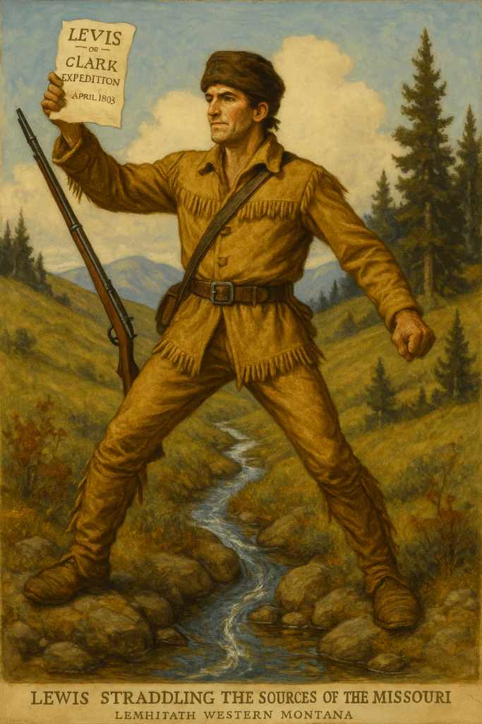
– Then I went alone to Lemhi Pass, where Lewis found what he regarded as the “source” of the Missouri River. This was August 12, 1805. He wrote that this was the fulfillment of a “grand project” that had been central to his life plan for many years. He wrote: “two miles below McNeal had exultingly stood with a foot on each side of this little rivulet and thanked his god that he had lived to bestride the mighty & heretofore deemed endless Missouri.”
Naturally, I not only bestrode the rivulet but took approximately 231,000 selfies in that preposterous posture. Lewis retained his dignity by saying that it was his subordinate colleague, Hugh McNeal (the Irish Catholic), who did the bestriding. I filled several vessels with the sacred water. I prayed, recited, and mused for a full two hours, in part because the weather was perfect (74 degrees, with a noticeable but not strong breeze), and mostly because I have so much to be grateful for this year (more than I have had for several decades). Silly as it may seem, I truly thrill (goose bumps, animal noises, a hard-to-describe ecstasy) to stand at the source of this river (or any great river), and I thank whatever celestial being is listening that I have lived to bestride, again, “the mighty and heretofore deemed endless Missouri.”
Naturally, I not only bestrode the rivulet but took approximately 231,000 selfies in that preposterous posture. Lewis retained his dignity by saying that it was his subordinate colleague, Hugh McNeal (the Irish Catholic), who did the bestriding. I filled several vessels with the sacred water. I prayed, recited, and mused for a full two hours, in part because the weather was perfect (74 degrees, with a noticeable but not strong breeze), and mostly because I have so much to be grateful for this year (more than I have had for several decades). Silly as it may seem, I truly thrill (goose bumps, animal noises, a hard-to-describe ecstasy) to stand at the source of this river (or any great river), and I thank whatever celestial being is listening that I have lived to bestride, again, “the mighty and heretofore deemed endless Missouri.”
While I was there, two different pickups drove up, and one ATV. They lived nearby. They were tooling around. One man brought an older man, crippled with old war legs, for a picnic, and the veteran lurched down the path to the picnic table. I wanted to say, “thank you for your service,” but I hesitated. Sometimes that feels so easy, so rote. The other men in pickups were friendly, curious about what I was doing way up there. I explained the importance of Lewis’s August 12, 1805, moment and urged them to go down and bestride the “mighty and heretofore, etc.” Missouri. This did not win any converts. Both of them invited me to explore the area more fully, including on their private land, and offered to be of assistance if I wanted to see more. One of them subsequently wrote me several excellent emails suggesting places I ought to see there.
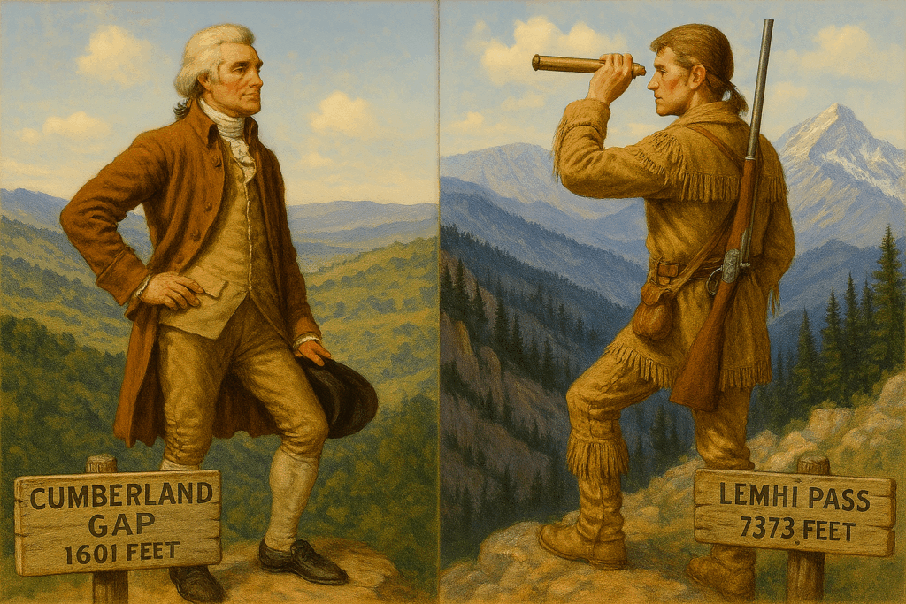
– Then I drove up to Lemhi Pass, which is 7,373 feet in elevation. The Cumberland Gap, at the convergence of Kentucky, Tennessee, and Virginia, is 1,601 feet. That’s five times lower than Lemhi, Mr. Jefferson! I got out and did some gag videos. The usual notion in Lewis and Clark studies is that when Lewis climbed up to the ridge and looked to the West, he was so devastated by the “range upon range” of mountains still between him and the Pacific that his knees sagged, etc. Note: there is not a single reference in the million words of the Lewis and Clark journals about sagging knees — certainly none at Lemhi Pass. My friend David Nicandri, who specializes in puncturing Lewis and Clark myths (as he sees them), gives lectures showing slides of the view East and slides of the view West and asks the audience to identify which is which. Point taken. Nicandri notes that Lewis expresses no disappointment, regret, misgivings, concern, or anxiety upon topping the Continental Divide. He simply mentions that there are several mountain ranges to get through. Without even a hint of chagrin. So every time I am there — in this age of connectivity — I tape a re-enactment of the Lemhi Disappointment Trope and send it (from the Pass!) to Herr Nicandri on the coast of Washington. I hope I do not seem immodest when I say this year’s re-enactment was the most inspired of them all, worthy of a prize for a: running a gag into the ground over more than a decade; b: leading an almost entirely absurd life; and c: expressing my friendship for a fellow member of what Jefferson and his ilk called “The Republic of Letters.”
But when that was done, when the film was “in the can” as well as the empyrean, I found that I was not ready to leave the Pass. It was as perfect a day as one could ever ask. Meriwether Lewis is one of my heroes. He was a much more extraordinary man than we know, a truly gifted literary artist, a man of genuine integrity, a man of great discipline, and one of the first Americans to brood over what was to become of the trans-Mississippi West. I sense that it mattered more to him to reach the source of the Missouri River than the end of the continent (November 1805).

I tried to imagine the last hour before Lewis reached Lemhi Pass. Back at St. Charles, the Missouri was nearly a mile wide. For 15 months, he had directed a crew of raw volunteers more than 3,000 river miles, at about 15 miles per day, to this place, this moment. The physical exertion of the men who propelled the boats up the Missouri River, portaged around the falls (18.25 miles), and dragged what was left of the flotilla up the last miles of the Jefferson-Beaverhead River was essentially appalling. These men had earned every mile of the laborious ascent. Lewis, too. And alone, Lewis had to carry the mission in his conscience. That, more than anything else, I believe, undid him. Beginning before the expedition returned to St. Louis.
What must Lewis have thought and felt as he climbed the last mile to the source (and beyond it, the pass to the Columbia basin)? It must have been one of the handful of happiest days of his life. Short list: 1. Getting the letter from Jefferson inviting him to become the president’s private secretary (April 1801). 2. Leaving Fort Mandan on April 7, 1805: “We were now about to penetrate a country of more than 2,000 miles in width upon which the foot of civilized men has never trod.” 3. “Discovering the great falls” (June 13, 1805). 4. Lewis’s enchanted day at the falls in which his field experiences pushed beyond the envelope of the rational Enlightenment (June 14, 1805). 5. The day he made successful contact with the Shoshone without Sacagawea (August 13, 1805). 6. Drinking from the source of the Missouri.
When Lewis got to the shore of the Pacific a couple of months later, here’s what he wrote: NOTHING. Not a word. He did not take a single hour to write his thoughts and impressions (and sense of accomplishment) at having successfully led a transcontinental exploration mission from Pittsburgh to Astoria, with all but one of his men still alive and healthy. I could spend a dozen pages here trying to sort out why he didn’t bother to write up his triumph over the continent that day or that winter, but this much is certain. There was a mental fragility in the otherwise incredibly robust Meriwether Lewis.

I mused for an hour on Lemhi Pass. I was reluctant to get in my pickup and piece my way down the gravel roads to Dillon. The place. The view. The historical importance. The pure joy of being there. The temperature. The breeze. The indecipherable mystery of Meriwether Lewis’s decline and death. The sense that such a moment as this happens at best once a year, sometimes in the presence of the ho-hum crowd.
Exhausted after a full month of Montana adventures, I drove two days ago to Superior, Montana, northwest of Missoula, where there is a truly lovely and tranquil National Forest campground. Off the grid. Only eight or nine other rigs in a campground of more than 100 slips. Giant yellow ponderosa pines. The Clark Fork River is within slingshot distance.
I realized that I was still in Montana, but it felt like Idaho. I read and rested, wrote and napped, strolled and read, and made all sorts of life plans.
And now I am out. There are several more such hectic months of things I want to see and do in Montana, including canoeing a section of the Missouri I have never seen (in two weeks), Judith Landing to James Kipp, through the breaks and the badlands of the fourth-longest river in the world.
I’m a very proud North Dakotan, but I confess: if there were only one state, it would have to be Montana.
Follow Clay and the LTA Airstream as he retraces the famous Lewis & Clark Trail from 1804-1806 across the continent. This 2025 expedition is a central part of LTA’s big initiative to explore the country and take the pulse of America as it approaches its 250th birthday. Be sure to follow Clay’s adventures here and on Facebook — and subscribe to our newsletter.